Make your maps region-aware!
Without the need to enter borders
Traditional marker clustering approaches for maps are a little crude, really.
Based only on proximity, these maps suffer from bloated cluster outlines with meaningless population counts.
RegionBound removes the confusion and steers visitors to the right regions...
Plus it adds region-aware aggregations.
Scroll through to learn more.
Play
Play Drupal
Code
Buy
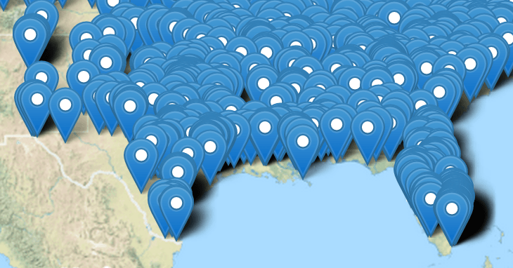
No clustering
1. This might be what you've got right now
If you still wonder why maps must have marker clustering, consider this multi-marker mess. Good luck panning, zooming and trying to make sense of this forest of data...
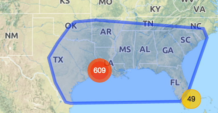
Random, bloated clustering
2. This is better, but ...
The same data, with traditional clustering added. Markers are now being grouped into clusters you can drill into. Which is great! But without region-awareness population outlines randomly cut across states, rendering the counts meaningless. Furthermore the outlines are bloated and suggest markers exists in areas that are clearly not populated (like the sea).
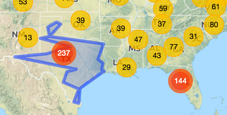

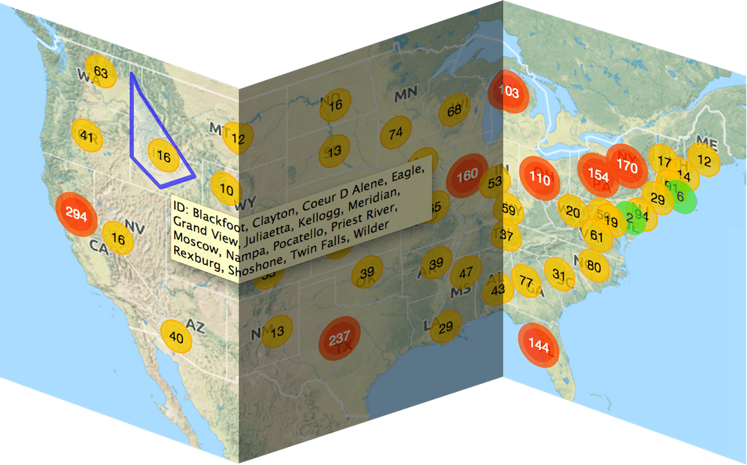
Region-aware clustering
3. Now we're talking!
Clustering the way it should be. One cluster and one count per state. That blue coverage outline reveals the real extent of the Texas marker population footprint, which is much more informative than the Texas state border (shown in white).
And you don't have to enter any GeoJSON or WKT to achieve this!
Play Play Drupal
Plus... region-aware
aggregation counts
4. Icing on the cake
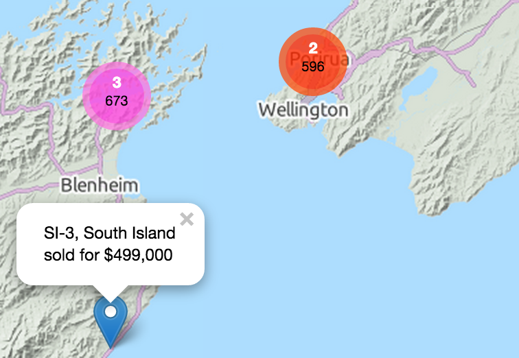
The plugin takes region-awareness to the next level through in-situ analysis of key performance indicators. If your markers represent locations of, say, real estate sales, select Average from one of the available aggregation functions and each cluster will not only display its population count, but also the average sale price across its region.
Cluster colours reflect the price ranges you defined. Thus medium-priced regions are immediately distinguishable from high-priced regions, at any zoom level.
Drop-in replacement or fresh start
The RegionBound plugin is based on a a fork of danzel's popular Leaflet.markercluster code. If you already use it, simply replace leaflet.markercluster.min.js by the new .js file (renamed) from the package download for an instant upgrade. Drupal users: no need to rename, just drop it in the same folder. Or start afresh and create beautiful maps using Leaflet. Your purchase gives you a leg-up with its complete examples that work out of the box.Do I need anything else?
A region hierarchy may consist of anything that makes sense in your application. Wine regions, for instance. Or postal addresses based on country, state, city and suburb. You add the region data as you add markers. Check out the CodeOr use Drupal (D7) and you do not have to code at all. Play Drupal
Drupal CMS
Drupal (D7) users have it so easy. No coding required. Enable the RegionBound plugin with module IP Geolocation Views & Maps and all you have to do is fill out the module's map configuration form.Download the plugin
Your copy is for a single hostname plus any subdomains as well as localhost.
Not-for-profit organisations may be eligible for free use - contact us.
After you have submitted your payment, please wait several seconds for the page to refresh while the plugin is being emailed to you.
You should receive receipt and plugin + documentation in two emails.
Check your spam folder, if you only see one email.
Are you ready to go RegionBound?
The RegionBound plugin:- clusters within regions, does not cross borders
- displays population counts and aggregation totals that make sense
- reveals underlying subregions when hovering clusters
- thereby also highlighting data errors
- fully supports mobile: a single tap on a cluster produces a population outline with subregions tooltip; a double tap zooms in and explodes the cluster
- features the traditional as well as a heuristic-hull for a tighter cluster coverage outline
- is high-performant
- works with Leaflet, not with the Google or OpenLayers APIs
Download your copy now.
What do I get with my order?
Upon payment you’ll receive by immediate return email an attachment containing:- the plugin, in optimized javascript code, ready to be used as a drop-in replacement for leaflet.markercluster.js, or in a new project
- demos that run straight in your browser, no server required
- simple and complete commented code for the included demos
- instructions on how to generate random locations for dozens of countries
- FAQs and tips